
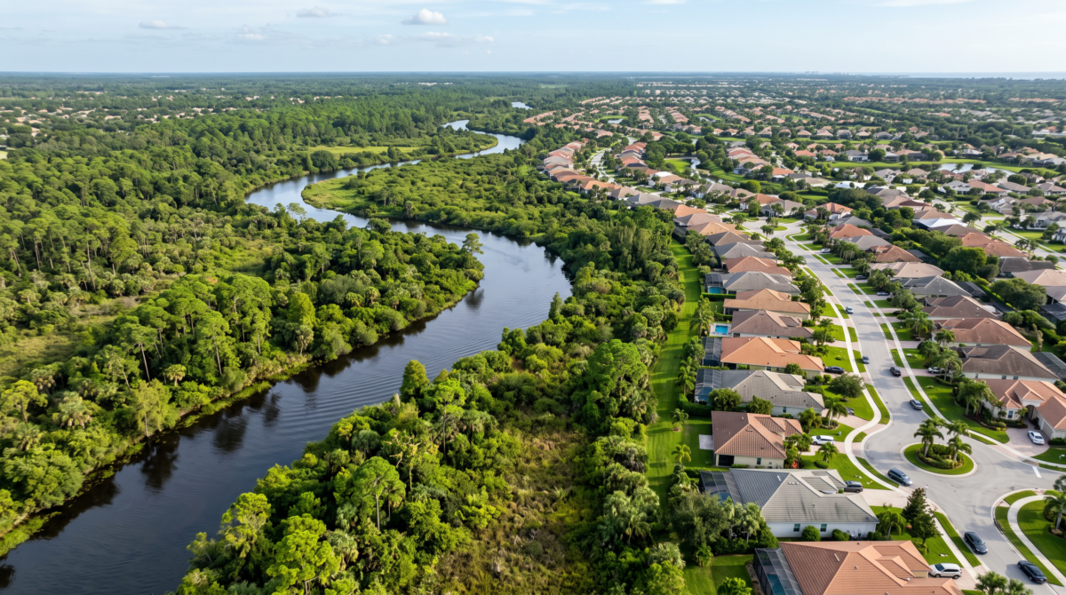
When most people think about zoning, they picture the basics: front and rear yards, height limits, permitted uses, parking counts. But for any property near a stream, river, lake, or wetland, there’s a second, quieter layer of regulation running underneath the zoning code — and it can be just as decisive for what you’re allowed to build. That layer is environmental setback regulation, and the most common form of it is the riparian, or wetland, buffer.
What Is a Riparian Setback?
A riparian setback (also called a stream buffer or wetland buffer) is a required distance that must be maintained between a proposed development and the edge of an adjacent watercourse, wetland, or water body. Unlike a standard zoning setback, which exists mainly to manage bulk, light, and privacy between structures, a riparian setback exists to protect an ecological function: filtering runoff, stabilizing banks, providing wildlife habitat, shading and cooling the water, and slowing flood flows before they reach a structure.
Why They Exist Alongside Zoning, Not Inside It
Riparian and wetland buffers usually don’t live in the same section of the code as your setback table. They’re layered on through an environmental overlay district, a natural resources chapter, or — as is the case in Hillsborough County — a separate regulatory body entirely. That layering matters because it means a parcel’s buildable envelope is often set by whichever regulation is more restrictive, not by the base zoning district alone.
In practice, that means a due diligence review isn’t complete once you’ve confirmed the zoning district and its setback table. You also need to ask: is there a wetland, pond, or watercourse on or near this parcel, and if so, what buffer applies to it?
How This Plays Out in Hillsborough County
Hillsborough County is a good illustration of how many layers can stack on a single piece of ground:
Land Development Code, Section 4.01.07 establishes the baseline: a minimum 30-foot setback from Conservation Areas and a minimum 50-foot setback from Preservation Areas — the county’s two classifications of protected natural resource land. The County can require a wider setback than the minimum depending on the sensitivity of the resource and the intensity of the proposed adjacent development (a large excavation next to a wetland, for example, is more likely to trigger a wider buffer than a small addition).
The Environmental Protection Commission (EPC) of Hillsborough County administers wetland review separately from the County’s zoning staff. That means a project can clear zoning review and still need a sign-off from EPC before a permit is issued — and EPC’s standards are not always identical to the County’s own natural resources chapter.
Special protection near the county’s major rivers. Hillsborough County’s code goes further for wetlands within 500 feet of the Hillsborough River, Alafia River, or Little Manatee River: land alteration that would destroy, reduce, or otherwise impair a wetland in that zone is prohibited outright, regardless of any approval obtained from another regulatory agency. In other words, a state or water management district permit does not override this local protection.
State and water management district review. Above the local layer sits Florida’s Environmental Resource Permit (ERP) program. The state minimum upland buffer is 25 feet, but that’s a floor, not a target — local governments routinely require more, exactly as Hillsborough County does. Worth noting for anyone with an active or upcoming ERP application: the Southwest Florida Water Management District (SWFWMD) is transitioning its ERP e-permitting to a new system, Appian, effective July 7, 2026, with new applications, modifications, and pre-application scheduling requests now required to go through that platform.
An encroachment path exists — but it’s a permit, not an exception. If a project needs to work within an otherwise-protected setback, Hillsborough County offers a Wetland Setback Encroachment Permit process. It doesn’t waive the buffer; it’s a formal review that weighs the proposed impact against the resource being protected.
What This Means for Your Project
If you’re evaluating a site anywhere near surface water, a few questions belong in your due diligence checklist before you get attached to a site plan:
- Is there a delineated wetland, pond, or watercourse on or adjacent to the parcel — and has that delineation been field-verified, or only estimated from aerial or FLUCCS mapping?
- What setback applies under the local Land Development Code, and does it differ from what a state or water management district permit would require?
- Is the parcel within any special protection radius, such as Hillsborough County’s 500-foot river buffer, where local rules can be more restrictive than state approval?
- Does the buffer reduce your usable lot depth enough to affect density, parking layout, or building footprint — and has that reduction been reflected in your yield study?
- Will the project need an encroachment permit, and if so, what’s the realistic timeline and likelihood of approval given the sensitivity of the resource?
These aren’t zoning questions in the traditional sense, but they behave like zoning questions in every way that matters to a developer: they constrain what you can build, where you can build it, and how long it will take to get there.
The Takeaway
Zoning tells you what a district allows. Environmental setbacks tell you what the ground itself will allow, regardless of the district. Skipping the second question is one of the more expensive mistakes we see in early site selection — buffers that show up late in civil engineering, after a purchase agreement is signed, can quietly erase a meaningful share of a site’s development potential.
At Zoningworx, our zoning verification and due diligence reports flag these environmental layers alongside the standard zoning analysis, so you know the real buildable envelope of a site before you’re contractually committed to it. If you’re evaluating a parcel near a wetland, pond, or waterway, this is exactly the kind of research to fold into your zoning report — reach out to our team and we’ll build it into your next order.
This article is for general informational purposes and reflects publicly available regulations as of July 2026. It is not a substitute for a site-specific wetland determination or a formal jurisdictional review. Buffer requirements vary by municipality and county — always confirm current standards with the applicable local zoning authority, environmental agency, and water management district before finalizing a site plan.