
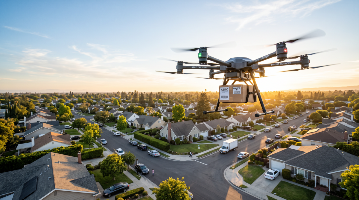

Drone delivery has moved from pilot program to real infrastructure faster than most zoning codes were written to handle. Amazon is now flying packages to customers in cities across Arizona, Texas, Florida, Michigan, Kansas, and beyond. Hospital systems from Cleveland to Salt Lake City to Charlotte are using drones to move prescriptions, lab samples, and medical supplies in minutes instead of hours. And in almost every case, the zoning question came up before the drone ever left the ground.
Where This Is Already Happening
Amazon Prime Air now operates fulfillment-center-adjacent drone delivery in Phoenix-area Arizona, San Antonio, Waco, and the Dallas-Fort Worth area in Texas, Tampa, Detroit-area Michigan, Kansas City, Kansas, and the Omaha metro in Nebraska — with Chicago’s south suburbs, Baton Rouge, and metro Atlanta in the pipeline. Notably, Kansas City’s launch required the Wyandotte County Planning Commission to specifically approve a request to build a launch pad at Amazon’s existing fulfillment facility — a real, on-the-record example of a drone operation triggering a formal local zoning/planning approval process rather than simply being folded into an existing warehouse use.
Hospital systems have moved just as fast on the medical side. The Cleveland Clinic partners with Zipline for what’s described as the first long-term U.S. drone medication delivery program, flying prescriptions within a five-mile radius of its Beachwood, Ohio administrative campus. Michigan Medicine uses Zipline to deliver prescriptions across Washtenaw County. Intermountain Healthcare’s partnership with Zipline delivers medications to homes around Salt Lake City. BayCare is building a Zipline-powered network across Tampa Bay, moving supplies between hospital facilities before expanding to patient homes. And Advocate Health recently announced what it’s calling the largest hospital-based drone network in the country, with Zipline flights planned across Charlotte, Chicago, Milwaukee, and rural Georgia by 2027.
Why Zoning Gets Involved
A drone delivery operation isn’t just an FAA question. The FAA governs the airspace — but the ground-level launch pad, charging station, or fulfillment-center addition is squarely a local zoning matter, and most municipal codes were never written with “drone port” or “unmanned aircraft launch facility” as a defined use.
That creates real, recurring questions for any company or hospital system considering one:
- Is this a permitted use under the existing zoning classification? Adding drone operations to an existing warehouse, fulfillment center, or hospital campus often means introducing a use — aviation-adjacent, in effect — that the underlying industrial, commercial, or institutional zoning district was never written to anticipate.
- Does it require a conditional use permit or variance? As the Kansas City example shows, even adding a launch pad to a facility a company already owns and operates can trigger a separate planning commission review specific to the drone operation itself.
- What do setback, height, and noise provisions actually say? A launch/landing pad and its flight path may implicate height limits, buffer requirements from residential zones, and noise ordinances that were written with entirely different equipment in mind.
- Nonconforming use risk. If a facility is retrofitted for drone operations without confirming the zoning actually allows it, that operation can end up as an unpermitted or nonconforming use — a serious problem if it surfaces during a refinance, sale, or expansion.
Why Our Utility Tower Zoning Reports Are the Right Tool for This
Drone ports are new. The zoning questions they raise are not.
Zoningworx has spent years analyzing zoning compliance for utility towers — cell towers, transmission towers, and similar vertical infrastructure — and that experience translates directly to drone port siting, because the underlying zoning questions are nearly identical:
- Use classification. Just as a municipality has to decide whether a cell tower counts as a permitted, conditional, or prohibited use under a given zoning district, the same analysis applies to a drone launch pad. Our utility tower reports are built specifically to identify how a zoning code classifies vertical, infrastructure-adjacent uses that most codes never explicitly named — exactly the gap most municipalities have with drone ports today.
- Height and setback analysis. Utility tower reports already document height overlay districts, setback requirements from residential property lines, and any FAA or aviation-related height restrictions layered on top of local zoning. A drone launch/landing pad raises the identical set of questions — how high can the structure be, how far from adjacent property, and whether an overlay district applies.
- Conditional use permit and variance precedent. Utility towers are one of the most common triggers for conditional use permit hearings in municipal zoning — planning departments already have an established process for reviewing exactly this kind of infrastructure addition to an existing property. That’s the same process the Wyandotte County Planning Commission used to approve Amazon’s Kansas City launch pad, and it’s the same process any company or hospital system should expect to go through.
- Nonconforming use protection. Utility tower reports are built to catch whether an existing structure was ever properly permitted under current code, since retrofitted infrastructure is exactly where nonconforming use risk shows up. A drone pad added to an existing warehouse or hospital campus carries that same risk if it isn’t confirmed against current zoning first.
In short: a drone port is a new use case, but it’s not a new type of zoning question. It’s a vertical, height-and-setback-driven, conditional-use-permit-prone piece of infrastructure being added to an existing property — which is precisely what our utility tower zoning reports are already built to analyze. Ordering that report before committing to a drone port site gets you a documented answer on permitted use, required approvals, and height/setback compliance, using the same rigorous process that’s already proven out on utility infrastructure nationwide.
What This Means for Site Selection and Due Diligence
For any company, health system, or developer evaluating a property for a drone launch facility, distribution hub, or hospital drone-delivery pad, zoning compliance isn’t a formality to check after the fact — it’s often the single factor that determines whether the site works at all before any capital is committed.
A Zoningworx zoning report addresses exactly these questions before you commit to a site: confirming the current zoning classification, documenting whether the intended drone operation is a permitted, conditional, or prohibited use under that classification, and flagging where a variance, conditional use permit, or rezoning would be required. For a use this new, getting a clear, documented answer up front is considerably cheaper than finding out during a planning commission hearing that the facility you’ve already built doesn’t have the zoning approval it needs.
As drone delivery keeps expanding into new metros and new use cases — retail, pharmacy, inter-facility medical transport — the zoning question will keep showing up right alongside it. Order a zoning report before you break ground on your next drone delivery site.
Related: the same category problem now applies to data centers. See data center zoning risk: what due diligence has to catch in 2026.
One reply on “Drone Ports and Zoning Codes: What Amazon, Hospital Systems, and Local Governments Are Learning the Hard Way”
[…] We have covered how this plays out for Amazon, hospital systems, and the local governments reviewing them in drone ports and zoning codes. […]